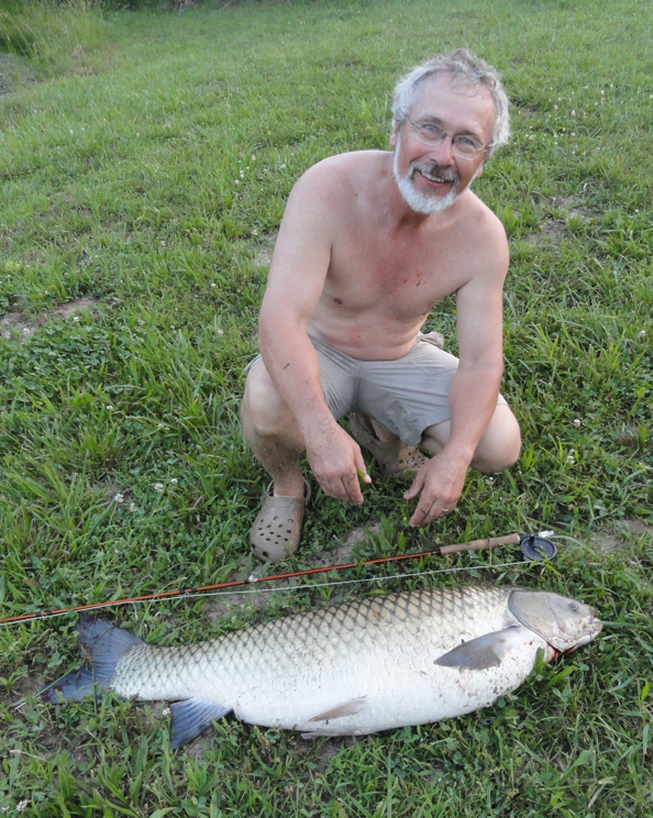
This was a trip Mary and I made in 2015. The write-up was done for OzarkAnglers forums. It's one of a number of old stories I'll be putting on here in the next few weeks.
It almost makes my head hurt trying to figure out times and dates when you fly to Australia. We just got home a couple hours ago, about 6 PM on April 9th...but the plane took off from New Zealand at 7 AM on April 9th. But we were in the air 4 hours from Christchurch NZ to Brisbane AU, then two hours in the Brisbane airport, then nearly 13 hours over the Pacific from Brisbane to Los Angeles, then 1.5 hours (barely made it through customs and immigration in time) at LA, then 5 hours from LA to Minneapolis, an hour in Minneapolis, then 1.5 hours to St. Louis. By my math, including the nearly 2 hours in the Christchurch airport, we were either in airports on in the air for a total of 30 hours.
Fortunately, both going over there and returning, we had accumulated enough frequent flier miles previously to be able to afford business class tickets. And I gotta tell you, if you're planning a long flight like that, you need to do business class if you can swing it. I saw how the peon class was on the flight. The seats on the Virgin Australia plane had SOME legroom, unlike the seats on the Air New Zealand flight we had getting from Brisbane to Christchurch earlier in the trip. But meanwhile, up in business class we had seats that were fully adjustable from fully upright to fully reclining like a bed and everything in between, we got food that was really about as close to gourmet as you can get on a plane, all the booze and soft drinks we could consume either at our seats or at a real bar with four barstools, a set of soft comfy pajamas, an overnight kit with toothbrush and toothpaste among other stuff. We had free movies and TV right at our seats on a good sized screen that swung out in front of each seat, along with chargers for cell phones and Ipads. And enough space in the two aisles to walk around all you wanted to without waiting for some fat boy to get past you. Both flying there and back, the stewards or whatever they are called these days dug out foam mattress pads and sheets after feeding us a big meal and seat up the seats as pretty darned comfortable beds, and then turned off the lights. It was a bit weird, given that we left Australia about 11 AM and were in bed within three hours or so of taking off, but we were running into the sunset and it was dark outside within an hour of lights out, and we got out of bed two hours before landing, at 4 AM LA time.
So the flights, instead of being a true ordeal, were actually about as much fun as I've had on a plane in a LONG time. As for the trip itself, here's what we did in a nutshell:
March 7th--left home early-early in the morning to catch a flight to, of all places, Atlanta, in order to get a connecting flight to LA. Arrived about 7 AM March 9th (yep, that makes my head hurt, too) at Brisbane (it's pronounced BRIS-bn by Australians), and immediately caught another flight to Melbourne (MEL-bn), where we met our Australian friends Krystii and Michael. Krystii is also an artist--we met them at an art show 15 years ago), and up until they immigrated to America 5 years ago Michael was the head of technology and heraldry at the Australian National War Museum. They were to be our guides and drivers while in Australia, and then just fellow travelers with us in New Zealand for the trip. Since they drive on the wrong side of the road in Australia and NZ, neither Mary or I wanted to have to drive if they were willing to do so. We rented an SUV and drove through Melbourne, then out an hour or two to Healesville, where we stayed the night at a couple of beautiful cottages in the Toolangirainforest.
March 10th--we liked the cottages so much we stayed there another three nights instead of going on to the next place, which was a couple hours away, for two nights. We hiked in the Toolangi much of the day this day.
March 11th--did another hike and some sightseeing, including visiting the area nearby where Krystii and Michael had lived for several years.
March 12th--more sightseeing and a visit to a wildlife park in Healesville, where we saw all kinds of indigenous Australian wildlife. Our friends had assured us that we'd see a lot of kangaroos on this trip, but other than at the zoo we only saw a half dozen roos at long distances. We did see quite a few wallabies, the smaller kangaroo critters, while hiking. The rainforest was magnificent, with mountain ash trees that were getting up to the size of the largest Douglas firs in North America. These were the biggest non-conifer trees in the world, and like most of the native Australian trees, were a eucaliptus species. Just as impressive, and making the forest look like something in which you'd expect to encounter velociraptors, were the giant tree ferns, some of them 20 feet tall. Mary, however, probably didn't enjoy the hiking as much as I did, because she'd read far too much and been told far too many stories about the myriad of snakes and spiders in Australia that can kill you very quickly. We never saw a snake outside of a zoo, nor any dangerous spiders, but Mary couldn't quite relax as much as I did while hiking.
March 13th--we drove to the small town of Corowa, taking the scenic routes and sightseeing. Michael was giving a talk at a gathering of military vehicle enthusiasts there that night, and the town was packed with authentic WWII vehicles and guys driving them around. We stayed at a modest but nice motel.
March 14th--We watched a big parade of the vehicles, then dropped Michael off at an extensive swap meet for vehicle parts and other wartime memorabilia while the rest of us walked all over the town and did a hike along the Murray River. K and M knew I loved to fish, and I think they expected me to fish the Murray for a while, but it was a big, slow river that didn't lend itself to fishing from the bank, and I had no clue how to fish for Murray cod, the predominant species in the river, anyway. We stayed the night hosted by friends of K and M in the not too far away town of Wangaratta.
March 15th--we did a long drive over the highest mountains in Australia (6000 feet elevation maximum, which gives you an idea that Australia isn't real mountainous) through Mt. Kosciusko National Park to Jindabyne. While the mountains may not have been all that high, they were spectacular, and the road was non-stop hairpin curves. It was extremely rugged country, with incredibly thick forests on the slopes and high alpine scenery near the tops of the mountains. After picking up groceries in Jindabyne, we drove a few miles out of town to the Moonbah River Huts to spend the night. The huts looked really good on the website, but were quite...rustic in reality. We'd always looked for places with separate bedrooms for the two couples and separate bathrooms as well. The hut we stayed in had a bed in the living room, one bedroom, and one bath (well, it was two rooms, with a sink and tub in one and a toilet in the other). It also had a barely working microwave and the stove was an antique wood-burning job. Mary had planned to make her famous dinner rolls, and it was a real adventure figuring out how to bake them in a wood oven.
March 16th--the reason we'd picked the Moonbah Huts to stay was mainly because they were on the Moonbah River, which was reputed to have good trout fishing. The river turned out to be a creek about 10-15 feet wide and completely closed in with very thick brush. It was fast and clear and the bottom consisted of very rough rock. After doing a hike in the morning back in the National Park, I bought a month's fishing license at Jindabyne ($14 Australian) and tried to fish it in the afternoon. It had quite a few little brown trout, which I caught on elk hair caddis (yep, they have caddis flies in Australia, though I never saw more than one or two in the air at once).
March 17th--after another night in the hut, we did another hike in the park during the morning. This forest was a little drier than the rainforest earlier, with smaller trees and brush not so thick. We hiked to a high waterfall and back. Then, while the other three did another short hike for a couple hours, I fished another stream, a little bigger than the Moonbah, that was coming out of the mountains, and finished achieving my Australian trout slam with a rainbow and a couple of little brook trout.
March 18th--after the third night at the hut, we drove to a high point in the park, with alpine scenery and beautiful alpine gums, another eucalipt. Then started the long drive to the Australian capital of Canberra (CAN-bru), where we stayed the night in separate one bedroom furnished apartments that were pure heaven after the Moonbah Hut.
March 19th--the plan for this day was for Michael to take us on a behind the scenes tour of his former place of employment, the War Museum, for a couple of hours, and then tour some of the other sights of the city. Well, the War Museum is, if not THE best, at least one of the very top museums of its kind we've ever seen, and we spent the whole day there. Not only that, but we also spent a good part of the next two days there as well. It covered, in depth, Australia's involvement in every war from WWI on, and if you didn't know it, until Grenada Australia had participated in every war of the 20th Century that America was involved in (and Iraq and Afghanistan too). There were vast amounts of artifacts and vast amounts of memorabilia and explanations of every aspect of every war. Dioramas galore, beautiful artwork, multimedia productions that were extremely well done. I still don't think we saw it all.
March 20th--we spent much of the day at the War Museum, and ate dinner with friends of K and M that night.
March 21st--well, at least we visited some of the other places of this beautiful city. Canberra was a planned city; it was mainly built in the 1950s specifically to serve as the capital city, and the government buildings and settings around them are quite impressive. We visited the National Museum of Art and the National Portrait Gallery, both of which had some very good art and some very bad art. We had dinner with two more friends of M and K, and spent our last night in the very nice furnished apartments.
March 22nd--we flew from Canberra to Brisbane. The Canberra airport, for a capital city airport, was small and uncrowded, and going through security there was a breeze, vastly unlike what it is at any airport around Washington DC. The two hour flight put us in Brisbane in mid-morning, and we lunched with another friend of Michael's, a former brigadier general in the Australian army who has retired to an ocean-front home where he is a gourmet cook. Krystii's mother lives in Peregian Springs, on the Sunshine Coast north of Brisbane, and after lunch, we drove the new rental SUV the 1.5 hours to her house, where M and K would be staying for the next few days while Mary and I stayed at a furnished apartment on Sunrise Beach a half hour away.
March 23nd--Mary and I enjoyed the Sunrise Beach. It is a spectacularly beautiful beach, and was nearly deserted while we were there, due to the fact that summer was over (barely). The water was a pleasant 75 degrees. I finally figured out how to convert Centigrade to Farenheit, since they only use C in Australia and NZ. 0 degrees C is 32 degrees F, and from there, for every five degrees it goes up in C, it goes up 9 degrees in F. So 5=41, 10=50, 15=59, 20=68, 25=77, 30=86, 35=95. Air temps never got above 30 C in Australia while we were there, but the beach area was very humid. The water was nice, and the waves were just big enough to be fun to play in and try boogie-boarding.
March 24th--Mary and I established a routine of walking two miles up the beach each morning to the nearest town area, where we found a nice place to eat breakfast with free WiFi so we could check emails and play on the internet for a while. Then we'd come back down the beach, and by that time it would be warm enough for a swim to be nice. In the afternoons we'd explore the area with K and M and M's mom.
March 25th--on this day we found a huge colony of fruit bats (flying foxes) right in a nearby town. There were thousands of these bats the size of rabbits. They were just hanging from the tree branches in huge clusters, fanning themselves with their leathery wings, climbing from one spot a better one occasionally. In the evening we watched them fly out of the trees in numbers darkening the sunset skies, branching off to go in three different directions (just not out over the ocean).
March 26th--highlight of this afternoon was a pontoon boat trip up the Noosa River, where I tried my luck at fishing, catching a bunch of little catfish that looked very much like small blue cats.
March 27th--after a final night at the beach apartment, we drove to Brisbane to catch the flight to New Zealand. We arrived in Christchurch very late, near midnight, and spent the night in a motel close to the airport.
March 28th--We drove through the city center of Christchurch, which had been all but destroyed by a huge earthquake just a few years ago. Construction was everywhere, as were crumbled and damaged buildings. Then we headed off to the west across the Canterbury Plain from Christchurch on the South Island, over Arthur's Pass in the Western Alps. On the east side of the mountains it was dry and warm and sunny, with scrubby vegetation, but by the time we reached the pass we were in fog and rain. We stopped at the town of Arthur's Pass to pick up info on the national park there, and Mary and I hiked an hour or so in the rain to a magnificent little waterfall. Then we drove down the west slope in rainforest to the narrow coastal plain on the west coast, and down it to the tiny town of Okarito, where we had a house rented for the next two nights. The house wasn't much, but the little settlement was quaint.
March 29th--we spent the day driving to the Franz Josef and Fox glaciers. These are the only glaciers on earth that drop straight off mountains into rainforest, and they are spectacular. We hiked up as close to the glaciers as we could get--it gets dangerous to get too close since they are continually dropping huge chunks of ice. Then we hiked through the rainforest below and across a suspension bridge over the wide, brawling, silty glacial river below the ice.
March 30th--we kayaked the Okarito Lagoon in the morning, a tidal lagoon full of various wading birds and waterfowl, not all that impressive though. Then we headed back across the mountains through awe-inspiring scenery, headed for the town of Wanaka and another slice of heaven after the disappointment of Okarito, a fine furnished apartment in the middle of Wanaka.
March 31st--I'm not sure what everybody else did the next two days, because they were my New Zealand fishing days. I'd hired a guide (expensive--over $500 a day in U.S. dollars), and on this day we drift fished the Makaroa River above Lake Wanaka. This was a smallish river, barely floatable in the low water of early autumn, flowing through a vast bed of glacial gravel and surrounded by mountain scenery. It was extremely clear, and to be honest, it probably had fewer fish per mile than any river I'd every fished for trout. After all, you could see just about every fish there was, and in five miles of river I doubt that we saw more than a couple dozen fish. But they were all big...and wary. This was technical fishing, where you absolutely couldn't make a mistake and catch a fish. If you lined them they were gone. A bad drift and they were gone. A fly that slapped the water a bit too hard and...well, you get the picture. Montana fishing is combat angling in comparison. I got several to take dry flies, and finally landed one big rainbow, a good 22 inch fish.
April 1st--on this day we fished the Clutha River, and it was very different. Big water, as big as the White River when they have a lot of generators working. Fast, clear...and a lot more fish but most were a lot smaller. I caught a bunch of fish on dry flies and a few on streamers, but only a couple were worthy of pictures. And some of the biggest ones were lying along the banks in shallow water, 1-2 feet, often under overhanging willows. It took accurate casts and good drifts to get them to take, and although I got several big ones on, it was one of those days when I couldn't keep them on. Still, it was a great change of pace after the previous day.
April 2nd--with one more full day in Wanaka, I had the option of fishing on my own for the day, but instead we hiked up a mountain overlooking Lake Wanaka, and spent the rest of the day roaming around the very nice town and walking along the huge lake.
April 3rd--we left Wanaka, headed first for Queenstown, where we had plans to do ziplining down a mountain overlooking the town. Mary and I also thought about mountain biking down the same mountain, and were about to rent the bikes when we were convinced by the livery people that it was probably not something we would want to do. The mountain was about 3000 feet high and scary steep, and the biking consisted of taking hairpin curves at speed on a trail no wider than you are, jumping boulders, etc. And we weren't especially interested in the ziplining, so while M and K ziplined, Mary and I had a nice, long, strenuous hike on the other side of the mountain, one of the best hikes of our whole trip and away from the hordes of people roaming around the touristy area at the top of the gondola ride from where the ziplines and luge rides and mountain biking started, and where our hike started as well. Then we drove on to Manapouri, a tiny town on the huge lake of the same name, nestled in the mountains. The house we had rented there was plain but clean, and was just an overnight stop.
April 4th--at noon, we toddled down to the lake and got on a big cruise boat for the 45 minute ride to the other end of the lake, where we got on a bus for an hour's ride on a piece of road that only connects the lake to Doubtful Sound, with no other connections. The NZ government had constructed the road to service a set of tunnels they built from the higher elevation lake to the Tasman Sea, with turbines to generate electricity. It was quite a scheme, and it made possible our cruise. When we reached Doubtful Sound, a huge fiord with several arms running into the sea, we got on a bigger cruise boat for an overnight cruise on the sound. This was perhaps the most spectacular place I've ever seen. The mountains rose straight out of the sound, often near vertically, for thousands of feet. Waterfalls pouring out of the high hanging glacial valleys were everywhere in towering thin ribbons dropping hundreds, even over a thousand feet. There were seals and sea lions out near the mouth, and dolphins back in the sound, and sea birds everywhere, but mainly it was just staring at the scenery with your jaw dropped.
April 5th--the room on the boat was small but very nice, with private bathroom. The evening meal and breakfast in the morning were excellent. The day before had been cloudy and rainy with clouds hanging on the sides of the mountains, but this day was sunny and the experience was totally different and no less spectacular. We spent the morning cruising parts of the sound we hadn't seen the previous day, and ended the cruise late in the morning, taking the bus back up the twisting gravel road and over the pass and down to Lake Manipouri, where we got back on the boat to take us across the lake to the car. From there, we drove out of the mountains and across rolling, hilly countryside covered in sheep, to Dunedin on the west coast and the cottage on the Otago Peninsula, which turned out to rival the Moonbah Hut in it's shabbiness. The beds were horrible, the carpet looked like it had experienced about 500 cats in the last 20 years, and the kitchen was none too clean.
April 6th--the reason we had picked the cottage was because it was close to the end of the peninsula, where there was the only mainland colony of royal albatrosses and blue penguins. We did the albatross tour, seeing a bunch of fuzzy young not yet fledged and a couple of adults flying around, and just before dark we did the penguin tour, which consisted of going down to a small patch of beach and watching these tiny penguins the size of frying chickens coming out of the sea and waddling accross the sand and rocks and up into their nighttime burrows in the grass. It was pretty cool.
April 7th--we explored the peninsula, including a nice hike in native forest and down to two other beautiful beaches. We stayed at the second beach late enough to see a few yellow-eyed penguins coming onto shore, and then headed back to the tiny town on the peninsula where the cottage was, and where we had a great meal in a nice restaurant.
April 8th--we said a not so fond farewell to the grubby cottage and started the five hour drive back up the coast to Christchurch, stopping only to take in the Moeraki Boulders, a tourist trap along the highway but still the boulders themselves were interesting, almost perfectly round, smooth rocks up to five or six feet across that dotted the sandy beach, with a few emerging out of the higher bank behind.
April 9th--after spending the night at the same Christchurch motel we'd stayed at the beginning, we got up at 4 AM to catch the flight from Christchurch, the first leg of our journey back home.
Some random notes...
Australia is really big on round-abouts (traffic circles) and they really really work well when all the drivers know how they work. Traffic circles seem to be hard for American drivers to figure out.
Australia is also really big on speed limits, and there are traffic cameras everywhere. And you get a ticket if you go one kilometer over the limit, no exceptions, and points off your license big time.
Also, they are hard of drinking and driving. Legal limit is .05, and if you're over the limit you lose your license for a period ranging from 3 months to forever, depending upon how far over the limit you are and how many times you've been caught.
Every tiny town in both countries has a bakery or three, and these aren't donut shops, they mainly bake stuff like meat pies and sausage rolls, and for the most part the meat pies are absolutely delicious. Lots of variety and all of it good. And across from every bakery is a fish and chips place. They do fish of various species, not just generic fish, and the fish are terrific. The chips are simply fries and no better than anywhere in the U.S. but I could eat the fish every day.
They are also big on a chicken thing that's like pressed, battered, fried chicken parts in a big slab, but it's delicious as well. On the other hand, they don't do much of anything else all that well anywhere we ate. They love beets. Their burgers are huge and have thick slices of beets on them, along with lettuce and tomato and "tomato sauce", which is catsup, but they don't much use mustard.
New Zealand is really big on hedgerows. Hedgerows that are out in the middle of nowhere, and are so well-trimmed and maintained that they look like huge green concrete walls with perfectly straight sides, 10-15 feet high and 4-8 feet thick. Anyplace that is farming country is divided by thousands of miles of hedgerows like this.
New Zealand, both islands combined, has 4 million people and 50 million sheep. I never imagined there was that much of a market for wool in the whole world. They also grow a lot of red deer, the European version of elk, along with a couple other exotic deer species, to sell the antlers to the Chinese and for venison in the stores and restaurants.
The highest mountains in NZ only go up to about 10,000 feet, but they rise up out of very low ground or right out of the sea on the west coast, so they are incredible. We saw a number of the sights where the Lord of the Rings movies were filmed, and the country has really made a big deal out of being the site of "Middle-Earth". But it truly is spectacular and unique country.
There are no native land mammals in New Zealand, but a lot of introduced ones have decimated the native birds. And so have a lot of non-native birds. On the other hand, there aren't any snakes. Australian possums vastly outnumber even the sheep, and in some places the rabbits are so thick the ground seems to be moving. Over 100 native bird species are now extinct, due to the invasives and human hunting from the Maoris on, including the largest known flightless bird, the moa, and the largest by body weight eagle, the haast's eagle.
North American conifers grow as well or better in New Zealand as they do in North America. We came across 150 year old redwoods in Wanaka that were nearly as big as those in the forests of California, and Douglas firs that were at least as big as any I've ever seen. And the firs are highly invasive and crowd out native species in a matter of decades. The whole settled part of the country is a clinic on what NOT to do with introducing non-native species. Only the trout seem to have been a pretty good idea.

 The first thing to note is that you can still reach the old style gage from this page; you'll see a spot to click on "legacy real-time page". Who knows how long this will still be available, but it's still a possibility right now.
 You can use your finger to do the same thing on your phone if it's like my Iphone.
 However, on my phone, this bar with handles does not show up.
 Aha! Now we have a button to click on to change the graph from height in feet to "Discharge, cubic feet per second". So one click will change the graph to what I really want to see. It will also make the "display median" button operable. So, clicking on the discharge button and the median button, we get this graph:
 The graph is now for flow in cubic feet per second, and the median is shown as a dotted line going across the graph. Median is a VERY important piece of information. It is a good approximation of the normal flow for the time period, so we can see in this case that the flow was a bit above normal, even before the rain a few hours ago raised the river slightly.
 Of this information, median is the most immediately important. Median, as I said before, is a good approximation of what the river normally flows on this date or time of year. It is the flow of which 50% of all recorded flows for the date are lower, and 50% higher. The 25th percentile value is the flow number for which only 25% of the recorded flows were lower, and the 75th percentile is the flow number for which 75% of recorded flows were lower. The mean is the average of all flows recorded for the date. You might think it would be a better approximation of normal than the median, but it is not, because any really high water recorded on the date skews the average upward; the mean is always a significantly higher figure than the median. The lowest value and highest value show the lowest and highest flows ever recorded for the date, and the year in which they were recorded.
 Clicking on "Current/Historical Observations" just takes you back to the new gage page. "Daily Data" actually takes you to something resembling the OLD gage page, but with the default of showing the gage height and flow rate graphs for the last year. You can change the dates and time periods shown if you wish. The graphs:
  There is one more piece of info that I find useful to get from this page. Near the top of the page is a link to "Current stage-discharge rating". Clicking on it, you get this:
 It may look like gobbledegook, but scroll down past the first part to the three columns of numbers, which will continue farther down the page than shown here. These numbers will take just a bit of explanation...
 So you can see here that, for instance, a gage height of 2.30 feet (from the column on the left) means the river is flowing an estimated 644.24 cubic feet per second (from the column on the right).
 It shows the available data being the discharge in cfs for the time period from, in this case, 1922-10-01 to 2022-08-17. Click on the box on that, and then down below, you can make choices on the date range of the data you want to see, and a drop down menu of which table you want to see. The default is "mean", but if you click on the menu it will give you the choices of minimum, maximum, and a bunch of percentiles including "median". We already know that median is far more useful than mean or any of the percentiles. Minimum and maximum will give you the highest and lowest values ever recorded for each day of the time period you select. But, let's select a time period beginning with the earliest data and ending in the latest available, from Oct 01 1922 to Aug 17 2022, and then select median from the drop down menu. Hit "submit", and it gets us this:
 This is a table of the average median value for every day of the year throughout all the years of record available. In other words, this is a table of what normal flow for the river at the gage site should be on every given day. So if you want to know what the river should normally be flowing on, for instance, March 15th, 555 cubic feet per second is your answer. More interestingly, you can look at this table and see that the river normally flows more water at certain times of the year than others. In April and into May, it normally flows the highest, 500 to well over 600 cfs. While in September and October it will normally flow less than 200 cfs.
 Note that over on the left are links to click on for every gage in the state. On the right are figures for "Discharge, ft3/s" (that's what the stream at each gage is flowing presently) and "Long-term median flow (present date)" (that's the median or normal flow for the date). So immediately, you can see what the river is flowing now and compare it to normal. Much of the time, that's all you need to know. For instance, scrolling down the page, which is grouped by major river systems, to the Meramec River system, we get this:
 Say I'm wanting to know what conditions are on Big River near Richwoods, because I'm wanting to fish the lower middle river. I can instantly see that the normal flow there is 164 cfs, and it's flowing 190 cfs right now. That's plenty close enough to normal; the river should be in good shape. If weather conditions were stable and there hadn't been any rain in the last day or so, that would be good enough, no need to actually even visit the gage page. I have this page, the streamflow table, bookmarked on all my computers and my phone. All I have to do is click on it, and scroll down to the river I'm interested in, and see if it's near normal or not.
 Now, here is where the height in feet graph does come in handy. It's showing the river has risen from about 2.75 feet to 4 feet, and may still be rising. That's a rise of over a foot. A good rule of thumb is that a rise of more than a foot is fairly likely to mean a slug of muddy water. So now my fishing trip downstream from there is looking a little more iffy. Maybe I better either go now and hope I can get in some good fishing before the muddy water hits, or else look for a different place to go that isn't quite so chancy.
 You can see that there is no day of the year in which the median was under 100 cfs. So normally, that stretch would not get too low to float easily. If I still wondered if it could get too low during a really bad drought, I might change the drop down menu from "median" to "minimum". This would give me this table:
 See all those values below 100 cfs? So it IS possible for the lower Jacks Fork to get too low for easy floating, but only if there has been a VERY extended drought.